The Munich polytechnical institute developed original technology of positioning of NAVVIS which is based not on satellite signals, and on visual information.
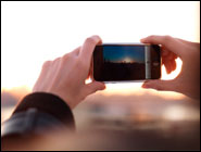
NAVVIS is an appendix for smartphones which allows users to find the current location on the card. Everything that for this purpose is necessary, – to photograph the district round itself. The appendix independently compares the photo to the image which is stored in a database, and defines exact position of the user (up to meter), and also the direction in which he moves. Thus it uses arrows to show the road in a three-dimensional projection.
In order that the NAVVIS system could function reliably, it was necessary not only to develop special system of recognition, but also to do big preliminary work. At first three-dimensional scanning of the district with the help ledara which creates a "skeletal" three-dimensional map of environment is carried out. After becomes the mass of a picture of buildings, including their characteristics, such as ladders and indexes. Then certain points on a three-dimensional map associate with pictures. Thanks to this information the navigation system allows to be guided in any space, for example, quickly to find "Mona Lisa" in Louvre.
However, unlike the museums, many buildings and streets are often reconstructed. How NAVVIS in such conditions will function, after all its database will become outdated? This problem is solved by users who shoot with the camera of the smartphone of change and thus update a database.
NAVVIS is ideally suited for regions where satellite navigation, for example in buildings, doesn't work at streets of the cities, in the subway, etc. Thus for work of NAVVIS it is possible to use wireless networks which also can be used for rough positioning. To use such system very easily: at an application launch of NAVVIS loads visual packages of data. The user takes a picture of the environment, and in fractions of a second the program compares it to a database of images and shows exact location of the user.
No comments:
Post a Comment